LoveTravelEngland
  • Home
  • About
    • Who, Why, How
  • The SWCP
    • SWCP Counties
    • Somerset & Exmoor Hikes >
      • Minehead to Porlock Weir
      • Lynmouth to massive storm
      • Lynmouth to Porlock Weir
      • Lynton to Lee
      • Holdstone Down to Lynton
      • Combe Martin to Holdstone Down
    • North Devon Hikes >
      • Ilfracombe to Combe Martin ​
      • Ilframcombe to Morthoe
      • Braunton to Morthoe
      • Barnstable to Fremington Quay
      • Bideford to Appledore
      • Westward Ho! to Appledore
      • Bucks Mill to Western Ho!
      • Buck's Mill to Clovelly
      • Hartland Quay to Clovelly
    • North Cornwall Hikes >
      • Padstow to Trevone
      • Mawgan Porth to Newquay
    • West Cornwall Hikes >
      • Hell's Mouth to Portreath
      • Carbis Bay to Gwithian
      • St Ives to Lelant
      • St Ives to Zennor
      • Zennor to Pendeen Watch
      • Land's End to Sennen Cove
      • Land's End to Porthcurno
      • Lamorna to Porthcurno
      • Penzance to Lamorna Cove
      • Penzance to Marazion
      • Marazion to Porthleven
      • Mullion Cove to Lizard Point
      • Cadgwith to Lizard Point
      • Coverack to Cadgwith
      • Helford Passage to Coverack
      • Falmouth to Helford Passage
    • South Cornwall Hikes >
      • Falmouth to Portscatho
      • Gorran Haven to Pentewan
      • Charlestown to Fowey
      • Charlestown to Pentewan
      • Portwrinkle to Rame Head
    • South Devon Hikes
    • Jurassic Coast Hikes >
      • Seaton to Lyme Regis
      • Abbotsbury to West Bay
  • Spring 2024 Trip
  • Fall 2023 Blog

The trek up to St Michael's Mount
​

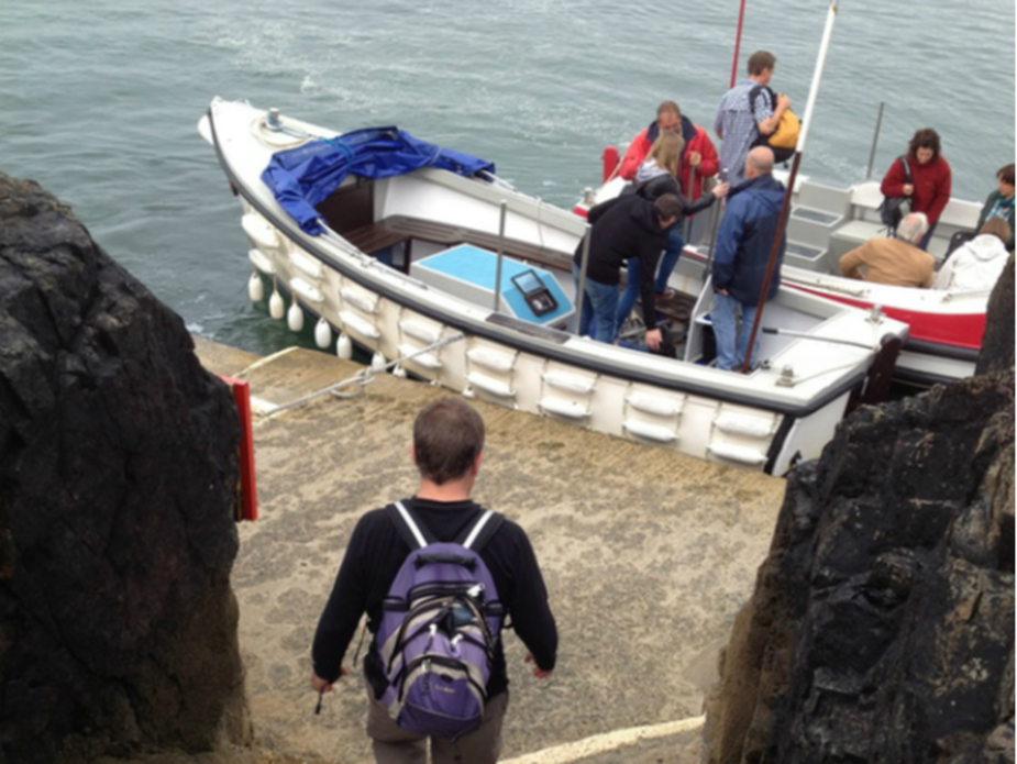
If the tide's in, you'll want to take a ferry to save your clothes from getting wet and yourself from looking foolish by being the only one swimming over. To get to the ferry, simply follow the stone path toward the big rock formation and you'll come out right here.
Picture
Picture
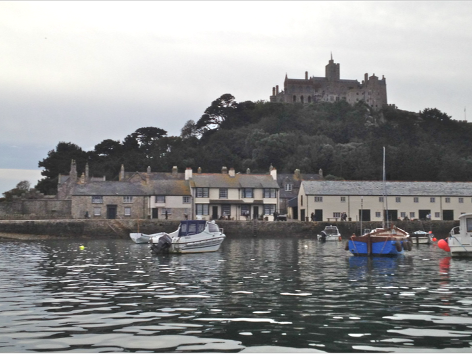
​The tide schedules are easy to find, so we knew that by the time we were finished, we'd be able to walk back on the really cool stone causeway. Once at the top we could see the path start to appear. By the time we'd finishing poking around the island for a few hours, the tide was completely out, following that ebb and flow thing that seems to run life. 
Picture
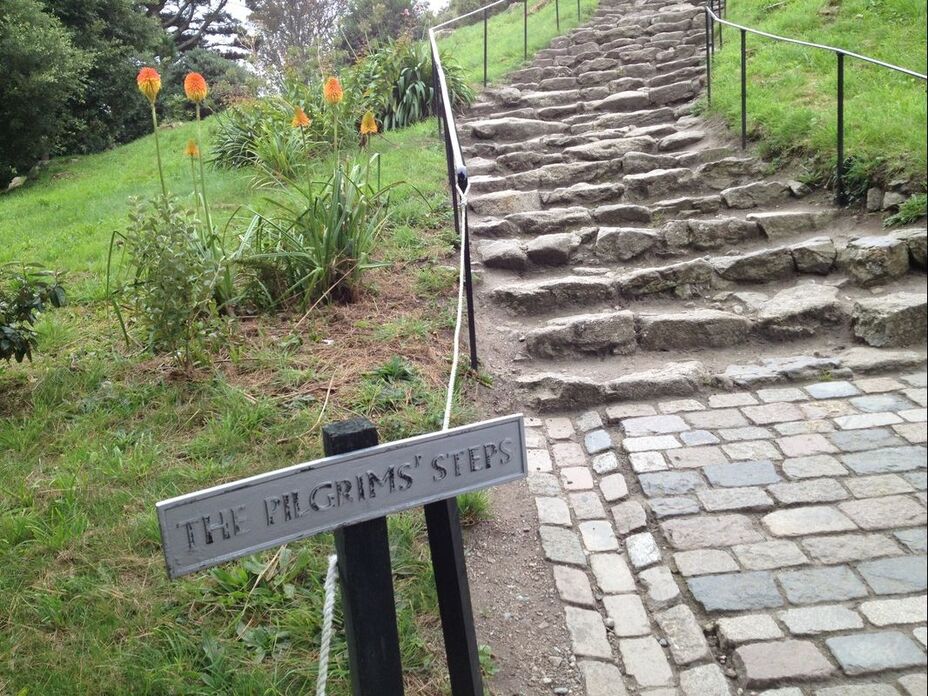
​You reach the castle via old steep historic cobbled steps that are pleasantly worn and crumbling. Did I mention steep? No wheelchairs or crutches need apply. No whining allowed. This is history dammit, and if it takes a year off your heart and knees, so be it. ​We join the countless before us to make the pilgrimage to the top—our cause less for religious purposes, more hellbent on pleasure seeking.
Picture
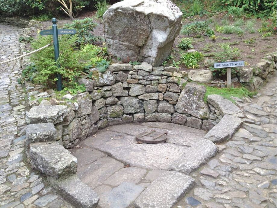
​The story goes that eons ago there was a nasty giant that wreaked havoc on the unsuspecting souls in the area, and that a boy named Jack did away with this giant by trapping him in this well. I for one am having a hard time believing this because it sounds so suspiciously like another Jack/Giant tale.
Picture
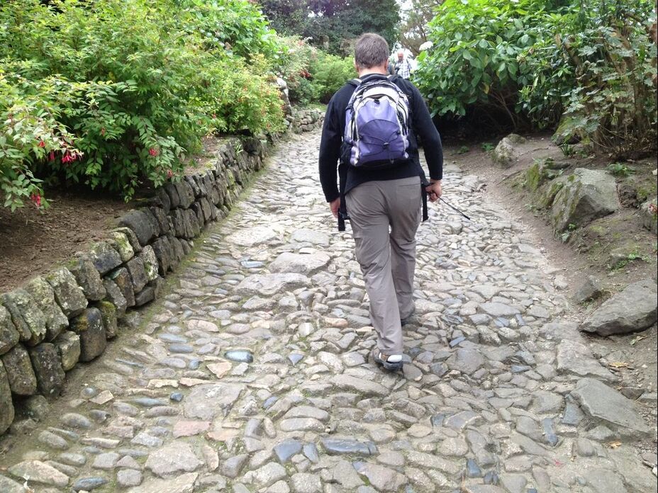
​Bob trudging up medieval pathways with backpack of water, raincoats, a thermos of tea, and fresh scones. Just the essentials, you know.
Picture
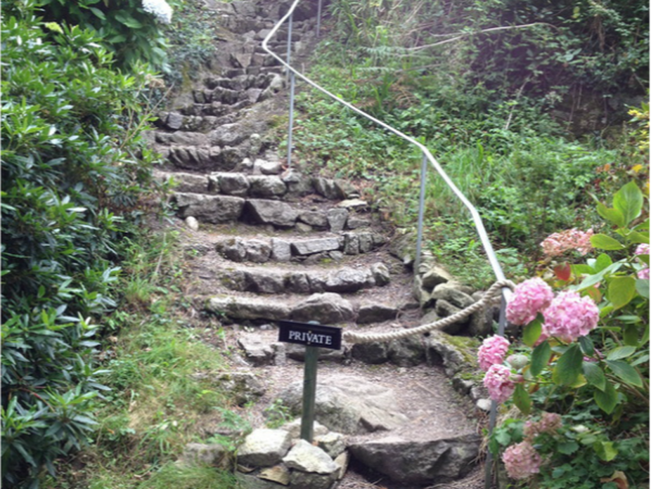
​I'm assuming this is a shortcut we pilgrims are not allowed to use.
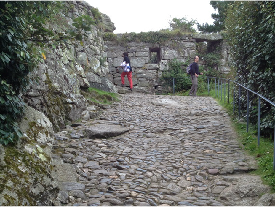
Picture
​Still not the top.
Picture
​Every single stone placed by hand.
Picture
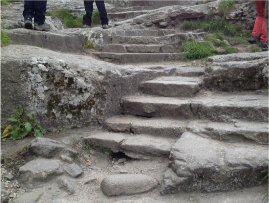
​More trudging up steep historic cobbled steps (placed by hand).
Picture
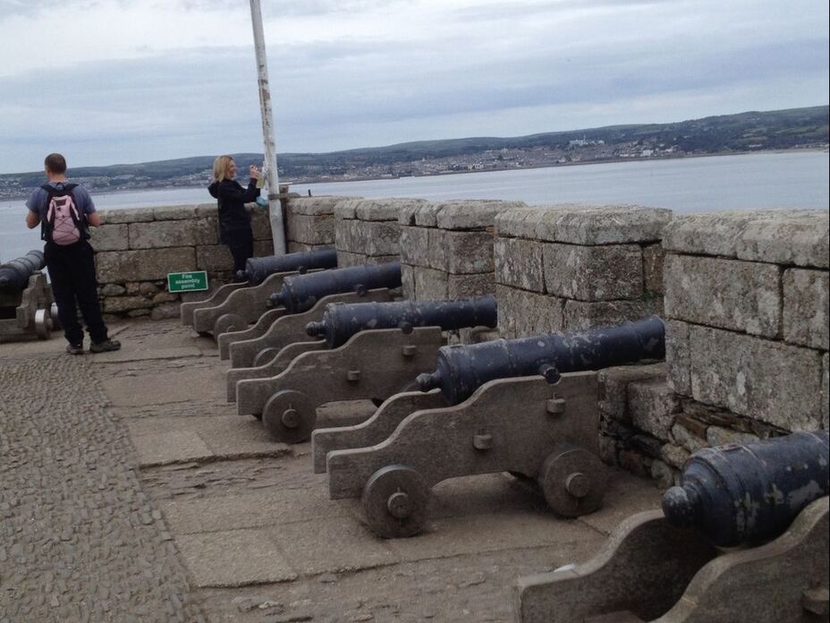
The landing just below the front door. Last chance to shoot at marauding bands of outlaws before wiping your feet and presenting your bottle of wine. 
Picture
Picture
​Stone handrail, as per OSHA.
Picture
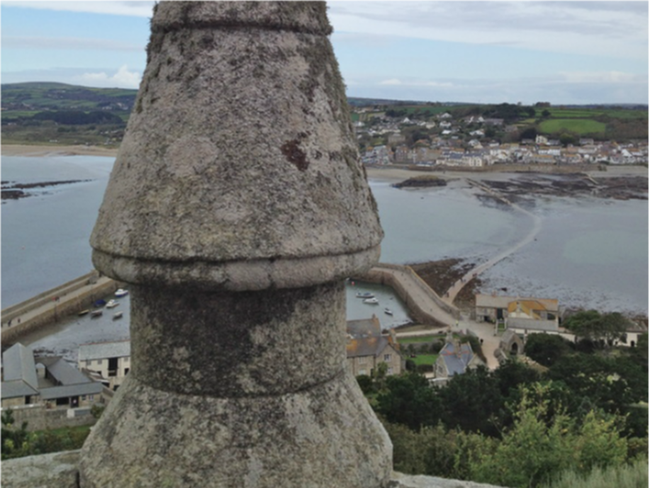
By the time we reach the top, the tide has mostly gone out and we can start to see the causeway.
Picture
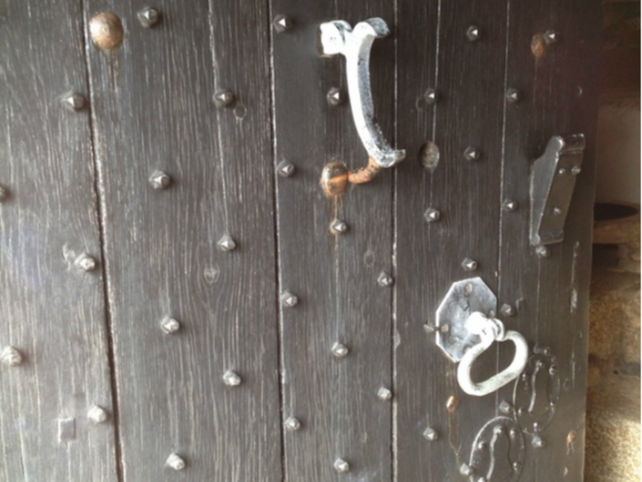
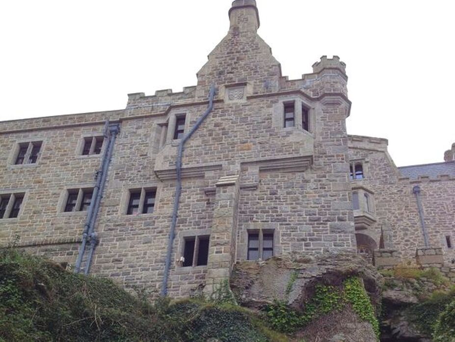
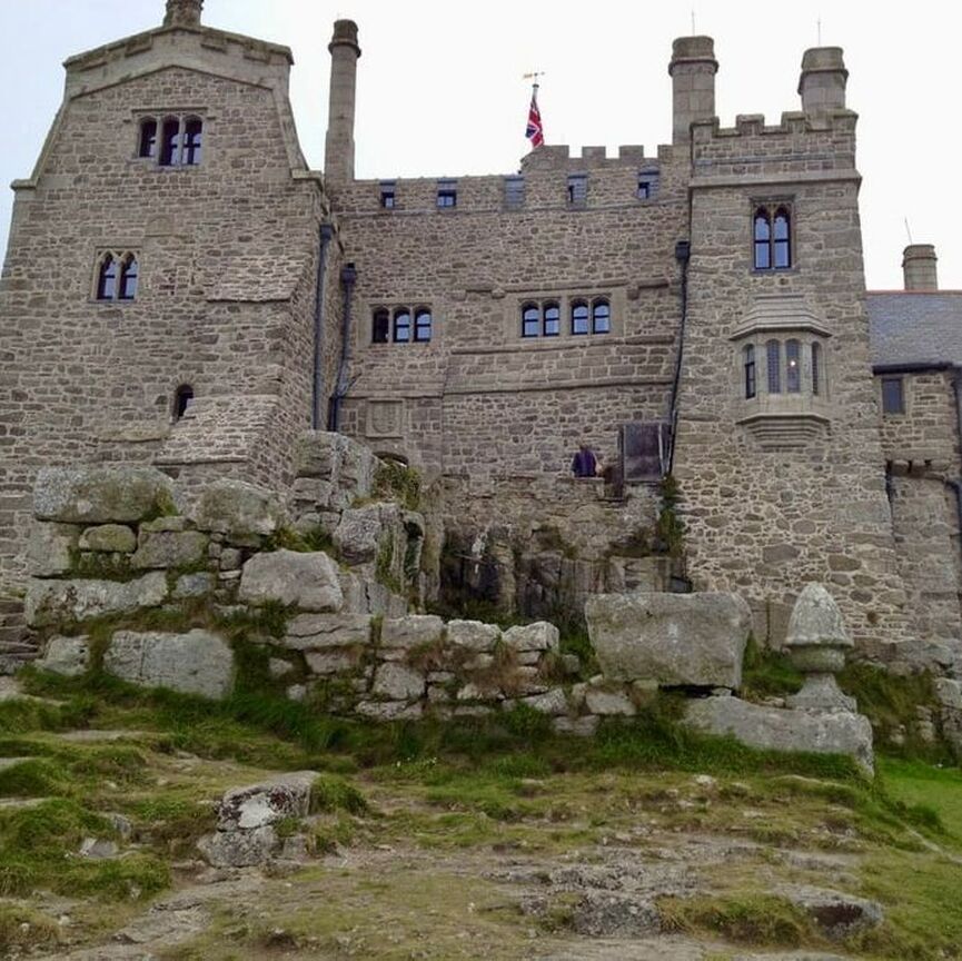
​Finally, the front door. 
Picture
​By the time we leave, we get to walk over the causeway.
see inside the castle
See the gardens

About: Who, How, Why 
The South West Coast Path
Three St Ives Slideshows
​Betsy's Trip  October 2023
Blog from Spring 2022
Blog from Fall 2022
​
Blog from Spring 2023
​

How to Build a Motte & Bailey
How a Lock Works
Big Burly Yorkshire Pudding
​
Mohorovicic Discontinuity at Coverack
First Attempt at Walking Hartland Quay
​
Contact


​Copyright © 2023
  • Home
  • About
    • Who, Why, How
  • The SWCP
    • SWCP Counties
    • Somerset & Exmoor Hikes >
      • Minehead to Porlock Weir
      • Lynmouth to massive storm
      • Lynmouth to Porlock Weir
      • Lynton to Lee
      • Holdstone Down to Lynton
      • Combe Martin to Holdstone Down
    • North Devon Hikes >
      • Ilfracombe to Combe Martin ​
      • Ilframcombe to Morthoe
      • Braunton to Morthoe
      • Barnstable to Fremington Quay
      • Bideford to Appledore
      • Westward Ho! to Appledore
      • Bucks Mill to Western Ho!
      • Buck's Mill to Clovelly
      • Hartland Quay to Clovelly
    • North Cornwall Hikes >
      • Padstow to Trevone
      • Mawgan Porth to Newquay
    • West Cornwall Hikes >
      • Hell's Mouth to Portreath
      • Carbis Bay to Gwithian
      • St Ives to Lelant
      • St Ives to Zennor
      • Zennor to Pendeen Watch
      • Land's End to Sennen Cove
      • Land's End to Porthcurno
      • Lamorna to Porthcurno
      • Penzance to Lamorna Cove
      • Penzance to Marazion
      • Marazion to Porthleven
      • Mullion Cove to Lizard Point
      • Cadgwith to Lizard Point
      • Coverack to Cadgwith
      • Helford Passage to Coverack
      • Falmouth to Helford Passage
    • South Cornwall Hikes >
      • Falmouth to Portscatho
      • Gorran Haven to Pentewan
      • Charlestown to Fowey
      • Charlestown to Pentewan
      • Portwrinkle to Rame Head
    • South Devon Hikes
    • Jurassic Coast Hikes >
      • Seaton to Lyme Regis
      • Abbotsbury to West Bay
  • Spring 2024 Trip
  • Fall 2023 Blog